Location History
This section describes how to get the Location history collected by the Veery agent (IOS and Android native).
Depending on how Veery was activated, Veery collects the geolocations and store them into the Cache.
The history of observe geolocation can be extracted from the Cache using the Location History functions.
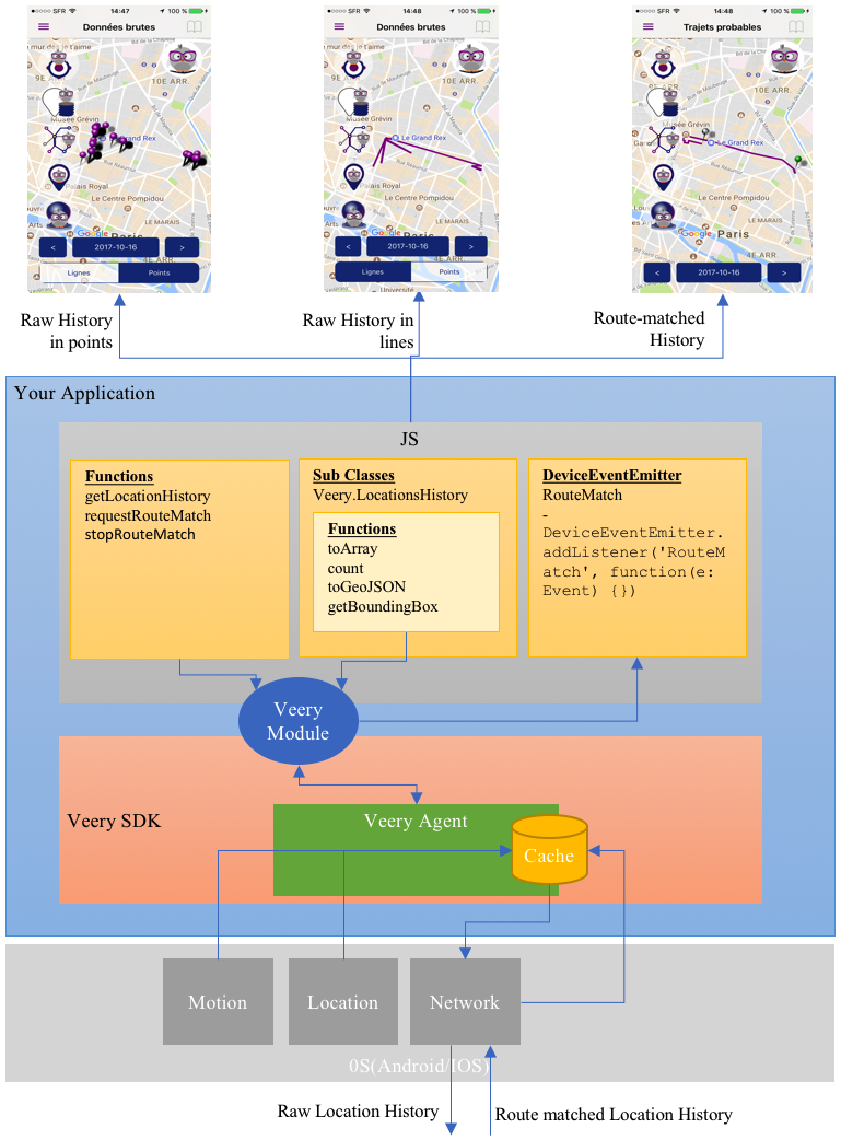
Veery offers three types of History :
- Raw data in points : the set of points as they were seen by the captors.
- Raw data in lines : the set of points as they were seen by the captors, but linked together as a MultiLineString GeoJson Object.
- Route Matched : These are historical data that have been completed by the Veery Backend and the Veery Geoprofiling algorithms. The Veery Backend will transform the Raw data points to "probable roads" considering times and speeds. At the most advanced version of the Route Matching, it uses the whole history of the user, detecting similar days and similar trips, using traffic jams and train timetables to find out what is the most probable road that the user is used to use. At the end it decides which probable road has the best fit with the raw data observed for each trip. In short : it fills the holes left by the low consuming trackings.
So, the level of Location History you can receive from the Veery agent depends on how Veery was activated :
| Veery activate mode | Raw in points | Raw in Lines | Simple route match | User geoprofile route-match |
|---|---|---|---|---|
| Veery.DEACTIVATE_ALL | ||||
| Veery.FOREGROUND | X (only "app active") | X (only "app active") | ||
| Veery.BACKGROUND | X | X | ||
| Veery.BACKEND | X | X | X | |
| Veery.GEOPROFILE | X | X | X |
Veery Functions
getLocationHistory()
Get Historical data of Geolocations observed during a given period of time.
Historical data can be requested in RAW or in ROUTEMATCH level.